"Chamonix France to Zermatt Switzerland"
By: Jean-Paul Courville

Imagine its your birthday and your gift is spending 14 days hiking in the Swiss Alps starting in Chamonix, France (Mont Blanc) and finishing in Zermatt, Switzerland (Matterhorn). You will trek close to 200 Kilometers (125 Miles) some nights you will sleep in a quaint Swiss village (hotel accommodation) and others in a high isolated mountain refuge. Be prepared to navigate thru and over glaciers, steep ascends, daily hikes of 8-12 hours, while eating all the cheese and pies your heart desires, are you in?
Well I sure am! I wasn't coerced to do it, I desired it and I planned it myself. I did have to convince someone special to travel with me on a self guided trek, a party of two with a map, wouldn't you feel confident?
I arranged my bookings thru;
Alpenwild https://www.alpenwild.com/index.php
They were superb by booking all accommodations for each day along with my detailed itinerary. They arranged it, sent me the map and I did the rest.
I celebrated my 46th birthday on July 17th, 2018 and the following day we flew to Geneva Switzerland making our way to Chamonix France. Although this was in July the weather was perfect, cool to freezing weather hiking in high mountains with snow yet mid altitude and lower towns with spring equivalent warmth while experiencing snow, rain, sleet, sunshine, and wind.
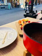
Swiss fondue, cheese, and hiking the Alps for two weeks
Day 1 – Arrive Geneva to Chamonix
Chamonix France is a beautiful town sitting on the base of Mont Blanc, a ski town with a warm feel. We had the opportunity to explore the town, cafes, eat french pies, gaze upon the views of beautiful mountainsides before preparing for the following morning.
Day 2 – Chamonix to Trient
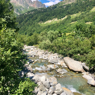
Our first day ascended thru the tranquil Chamonix Valley below the ribbed flanks on the north side of Mont Blanc. The early stages took us next to a river surrounded by trees before opening up to beautiful views and a steep climb. We had an option to take a cable car to the top of the ski lift where we continued on our route. We literally crossed the border of France and Switzerland by stepping over a line in the dirt where a stone was propped with the chiseled and painted words France on one side and Swisse on the opposite. We arrived in the lovely Swiss town of Trient where I learned areas in Switzerland are sectioned either predominately French, German, or Italian languages. The next 10-12 days would be in the French areas with Swiss cuisine.
Ascent: 3827 feet Descent: 3034 feet Distance: 13 miles
Day 3 – Trient to Champex
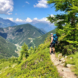
The first day seemed I was in a rush getting thru ski towns, crossing the border and getting to Trient but spending the evening outside after a shower, a warm meal, and while test flying my drone I settled into my own skin. I woke up the next morning with a calibrated sense of joy. We made an ascending route over Alp Bovine where you instantly capture the sweeping views, forests, and alpine meadows. We came along a solo refuge restaurant high atop Alp Bovine, and they were serving homemade apricot pie and coffee. These are the moments I have learned to seize and appreciate. It was a heavenly! We spent our evening at the lakeside hotel in Champex-Lac.
Ascent: 3047 feet Descent: 2329 feet Distance: 10 miles
Day 4 – Champex to Verbier
We had a gentle descent through valley pastures and traditional Swiss farming villages before arriving to Verbier. What a beautiful ski town mountain village, this is a place I would love to visit during the winter. Full of wonderful restaurants, mountain biking, cable cars, and places for shopping. We stayed at the exclusive alpine resort of Verbier on the sunny eastern side of Mont Blanc.
Ascent: 350 feet Descent: 2457 feet Distance: 8 miles
Day 5 – Verbier to Cabane de Louvie
This was my favorite day so far and leading thru day seven were my favorite days of the trip. Why? We were away from towns and villages, remote locations in snow capped mountains, waterfalls, glaciers, refuges (only one in each area we traveled) only helicopters could reach and there was no WIFI for days, you know its rugged now.
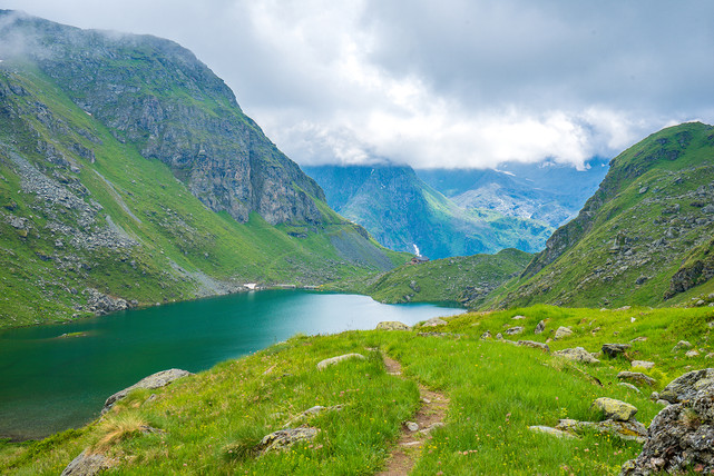
Today’s route ascended steeply above the Val de Bagnes along the Sentier des Chamois with commanding views extending to the Mont Blanc range. We finally arrived at the Cabane de Louvie on the shore of the beautiful Lac de Louvie with dramatic views of the Grand Combin.
Ascent: 2100 feet Descent: 1970 feet Distance: 6 miles
Day 6 – Cabane de Louvie to Prafleuri
You meet extraordinary people in these remote refuges, the staff who operated them live here for a week then when the helicopters fly in logistical support they turn over personnel weekly. We were thrilled to walk upon a herd of Ibex as we started at sunrise. We had seen a few the days previous atop mountain passes but these were unaware of our presence so we had the amazing opportunity to observe them for a while. I became obsessed with the Ibex, I looked up information every-time I had WIFI. One of my searches took me to a story of Otzi the Iceman whose stomach contents told scientist an Ibex was his last meal. One year later I was in the Italian Dolomite's and while traveling thru Bolzano Italy I learned that Otzi is in the South Tyrol Museum of Archaeology in Bolzano. I made a visit and the story came full circle.
Today the terrain was rugged as we crossed two challenging passes, Louvie and Prafleuri, the highest pass on the Hiker's Haute Route. We dipped into a rocky glacial section with a runoff stream. We stayed at the lovely Cabane de Prafleuri.
Ascent: 3609 feet Descent: 2247 feet Distance: 10 miles
Day 7 – Prafleuri to Arolla
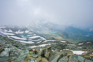
We crested a small pass then followed the lakeshore to the moraine of the Chelion Glacier where edelweiss flowers dot the rocky slopes. We crossed the dramatic Riedmatten Pass on newly-placed ladders and landings of the Pas de Chevre. The cloud coverage was intense on this day so we couldn't view what was suppose to be the first site of Matterhorn (far away), before descending into Arolla. Surely one of the most charming alpine villages along the route and a popular base for day hikes in the Swiss Alps.
Ascent: 2410 feet Descent: 4438 feet Distance: 12 miles
Day 8 – Arolla to Les Haudères
After three challenging and the most rewarding of days we had a gentle valley hike passing Lac Bleu. We walked the beautiful valley floor and the purely authentic and historic farming village of Les Haudères.
Ascent: 275 feet Descent: 2092 feet Distance: 6 miles
Day 9 – Les Haudères to Grimentz
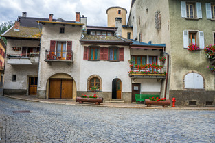
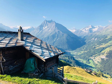
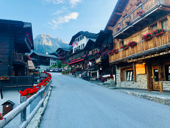
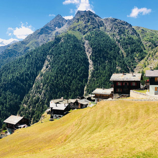
The sweeping alpine slopes are a delight. Snowcapped peaks like Dent Blanche (14,380) are nearby as we arrived at Lac de Moiry. The ancient village of Grimentz, one of the most picturesque and historic villages in the Alps is were we stayed. I fell in love with this place, its exactly what I imagined a Swiss Village to be, superb!
Ascent: 4503 feet Descent: 2198 feet Distance: 8 miles
Day 10 – Grimentz to Zinal
This beautiful route follows the forested contour of the Sorebois ridge before we made a descent into the peaceful village of Zinal.
Ascent: 1961 feet Descent: 3845 feet Distance: 5 miles
Day 11 – Zinal to Gruben
The beginning of today's route was an aggressive steep ascent, I was soaking wet in my own sweat before most people would have their first cup of coffee. Today we left the French-speaking region of Valais and crossed the Forcletta the German-speaking region of the Haute Route trail. For 11 days "Bon Jour" was the common greeting to hikers I crossed paths with. I knew we made the change when I greeted someone in the town of Gruben with "Bon Jour" and it was returned with "Guten Tag".
Ascent: 3933 feet Descent: 3451 feet Distance: 10 miles
Day 12 – Gruben to Zermatt
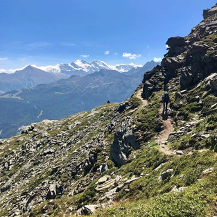
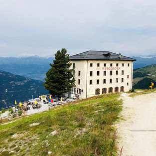
Crossing the final pass of the trip, the legendary Augstbordpass, we experienced sweeping views of Dom, the highest peak entirely within Switzerland, and stopped at the Weisshorn hotel for fresh blueberry pie on the terrace. We made the descent into Jungen / St Niklaus an what was described as an exciting gondola ride taking you to the valley floor where we finished the route and took the train to Zermatt. This gondola was small, steep, and upon arrival I honestly didn't think it was operable, I was mistaken. It was slow, swung in the wind and would stop abruptly during the descent (40 minutes). Hiking down the mountain from this location was beyond a steep drop and roughly a four hour decent, my knees after trekking over 120 miles said "ride the gondola or die here". I chose the ride.
1st Phase: Ascent: 3517 feet Descent: 3079 feet Distance: 8 miles
2nd Phase: Ascent: 1900 feet Descent: 1900 feet Distance: 6 miles
The Gondola Ride from Hell
Day 13 – Zermatt
We made it! Zermatt is a magical town, shopping, old and new merged with culture and cuisine. We took a train ride to view the Matterhorn, we wore normal clothes for the first time in two weeks without sweating or smelling yesterdays socks. I walked around the town in flip flops and eating pistachio gelato on a cone while reflecting.
Swiss fondue, cheese, and the Alps made this the best birthday I have experienced.
Day 14 – Zermatt to Geneva
Farewell....on the rail back to Geneva with a coke and a smile.

Bonus: They do bounce








































Comments